LARGE IMAGE OPENS IN A NEW WINDOW
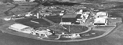
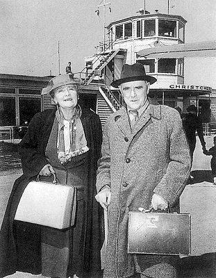
An aerial view of Christchurch Airport in the year that the overseas terminal was completed to the Left of the adjoining 1960 control tower and terminal.
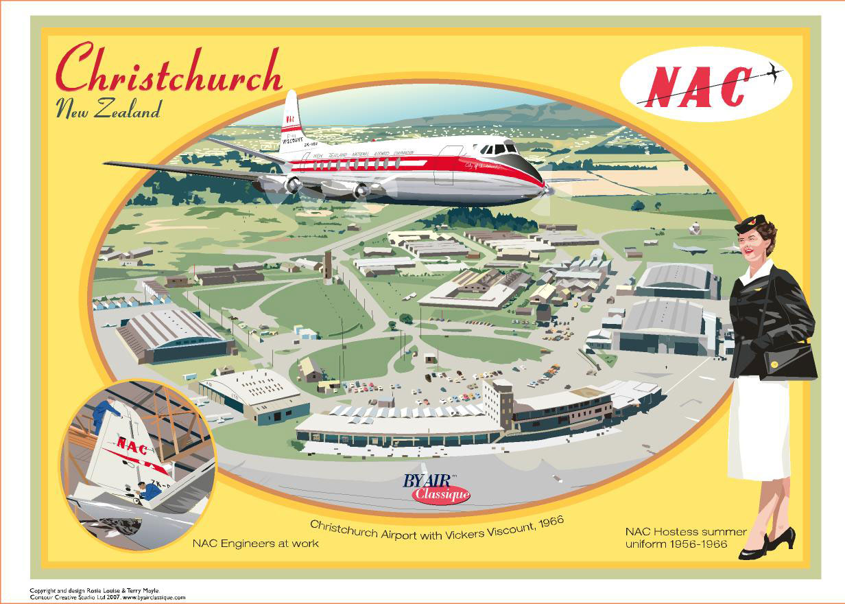
From a recent series of nostalgic postcards by Terry Moyle and Rosie Louise of Contour Creative Studio at Kaiwaka.
Christchurch Airport Timeline
1935 Christchurch City Council selected the present site at Harewood.
1936 227 hectares of land purchased.
1937 A 915 metre runway and 60 square metre terminal constructed.
1940 Harewood Airport opened for commercial flying.
1940 Airport used by RNZAF as a Training Base until 1945.
1946 Passenger terminal opened in former RNZAF hangar.
1948 An additional 260 hectares of land purchased.
1950 December 16, Harewood Airport becomes New Zealand’s first International Airport - 100 years to the day from the arrival of the first Canterbury Association settlers.
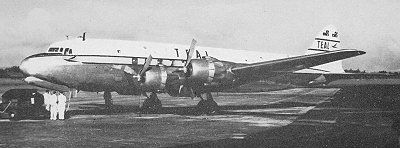
1951 First regular South Island trans-Tasman flights begin from Melbourne to Christchurch.
1953 Christchurch hosted the "Great London to Christchurch Air Race" the first time the route had been traversed in less than 24 hours. The "last great air race" was won by an RAF Canberra bomber.
1955 United States Antarctic Operations begin in Christchurch. December 20 first Antarctic flight by US Navy Operation Deep Freeze.
1957 November 21, four killed in a SAFE Air Bristol freighter crash at Russley golf course.
1959 Burnside Road renamed Memorial Avenue as a memorial to the airmen killed in World War 2.
1960 New 6,000 square metre terminal opened.
1962 The main runway was extended to 2,442 metres providing for commercial jet operations.
1966 An International wing was added to the Domestic Terminal.
1975 Extensions to the Domestic Terminal were completed, extending the total floor space to 16,000 square metres.
1980 New International Arrival Hall completed providing an additional 2,800 square metres of floor space.
1984 Main runway extended by 845 metres to 3,287 metres.
1987 Terminal extended to accommodate Ansett New Zealand and Air New Zealand lounges and domestic air bridges.
1988 Christchurch International Airport Limited was established, as a company owned 75% by the Christchurch City Council and 25% by the New Zealand Government.
1988 International check-in and departure area extended by 2,320 square metres.
1989 International arrival area extended by 1,100 square metres and air bridges and associated facilities of 1,000 square metres added.
1990 International Antarctic Centre opened.
1997 Redevelopment of airport public carpark completed with an additional 340 parking spaces.
1998 New International Terminal Building completed creating an additional 28,000 square metres of new floor space.
2007 5.4 million passengers.
2008 Plans announced for the replacement of the 1960 terminal. With a 45 metre high control tower and a cost of NZ$195 million, the development will be completed in late 2010.
From a recent series of nostalgic postcards by Terry Moyle and Rosie Louise of Contour Creative Studio at Kaiwaka.
Christchurch Airport Timeline
1935 Christchurch City Council selected the present site at Harewood.
1936 227 hectares of land purchased.
1937 A 915 metre runway and 60 square metre terminal constructed.
1940 Harewood Airport opened for commercial flying.
1940 Airport used by RNZAF as a Training Base until 1945.
1946 Passenger terminal opened in former RNZAF hangar.
1948 An additional 260 hectares of land purchased.
1950 December 16, Harewood Airport becomes New Zealand’s first International Airport - 100 years to the day from the arrival of the first Canterbury Association settlers.
1951 First regular South Island trans-Tasman flights begin from Melbourne to Christchurch.
1953 Christchurch hosted the "Great London to Christchurch Air Race" the first time the route had been traversed in less than 24 hours. The "last great air race" was won by an RAF Canberra bomber.
1955 United States Antarctic Operations begin in Christchurch. December 20 first Antarctic flight by US Navy Operation Deep Freeze.
1957 November 21, four killed in a SAFE Air Bristol freighter crash at Russley golf course.
1959 Burnside Road renamed Memorial Avenue as a memorial to the airmen killed in World War 2.
1960 New 6,000 square metre terminal opened.
1962 The main runway was extended to 2,442 metres providing for commercial jet operations.
1966 An International wing was added to the Domestic Terminal.
1975 Extensions to the Domestic Terminal were completed, extending the total floor space to 16,000 square metres.
1980 New International Arrival Hall completed providing an additional 2,800 square metres of floor space.
1984 Main runway extended by 845 metres to 3,287 metres.
1987 Terminal extended to accommodate Ansett New Zealand and Air New Zealand lounges and domestic air bridges.
1988 Christchurch International Airport Limited was established, as a company owned 75% by the Christchurch City Council and 25% by the New Zealand Government.
1988 International check-in and departure area extended by 2,320 square metres.
1989 International arrival area extended by 1,100 square metres and air bridges and associated facilities of 1,000 square metres added.
1990 International Antarctic Centre opened.
1997 Redevelopment of airport public carpark completed with an additional 340 parking spaces.
1998 New International Terminal Building completed creating an additional 28,000 square metres of new floor space.
2007 5.4 million passengers.
2008 Plans announced for the replacement of the 1960 terminal. With a 45 metre high control tower and a cost of NZ$195 million, the development will be completed in late 2010.