Showing posts with label church. Show all posts

Jul 19, 2009

Spirit of Place: Christchurch 1862


1,792 x 768 PIXEL IMAGE OPENS IN A NEW TAB OR WINDOW

It is probable that this simple pencil sketch, the significance of which has long been forgotten, would have struck a deeply meaningful chord amongst our earliest pioneers. Indicating the extant of development a decade after those first settlers landed at this very place, it had been their first view of the swampy plain on which they would build a city.

This a restoration of a panoramic westerly view of the northern half of the city of Christchurch, in late 1861 or early 1862. The artist's vantage point is at the junction of Oxford Terrace and Kilmore Street, to the immediate west of the 1850 Bricks Wharf, which is just out of view to the Right. Here those pioneers arrived from Lyttelton, with their tents, heavy luggage and kitset houses and when the first land sales began on the 16th of April, 1851, this immediate vicinity was the most sought after.

Below top: The artist's position was near to the 1926 Bricks Wharf monument, seen in this 1935 photograph, with the Manchester Street Bridge in the distance. Below bottom: the site is approximately opposite where the Central Fire Station is now situated.

Attributed by us to the renowned architect Benjamin Mountfort (1825-1898), and probably intended as preparatory to a watercolur painting, the pencil sketch can be dated by, among other considerations, the absence of the first Oxford Hotel on the north-east corner of Chester Street East (now part of Oxford Terrace) and Colombo Street. Mountfort lived not far from this vantage point in Gloucester Street from 1860.

Above: to the near Left of the drawing, at what is now the south-west corner of Madras Street and Oxford Terrace is The Hollies, built in 1861 to Mountfort's Gothic design for the eccentric Christ's College Maths Master Christopher Calvert, it was the city's first stone house.

The central part of the panorama includes all of the buildings surrounding Market Place (now Victoria Square).

They are situated along Armagh, Colombo and Durham Streets (above), Chester Street, lower Whatley Road (now Victoria Street) and Cambridge Terrace, where the Town Hall is now sited (below). All of the accurately depicted buildings are identifiable from early photographs.

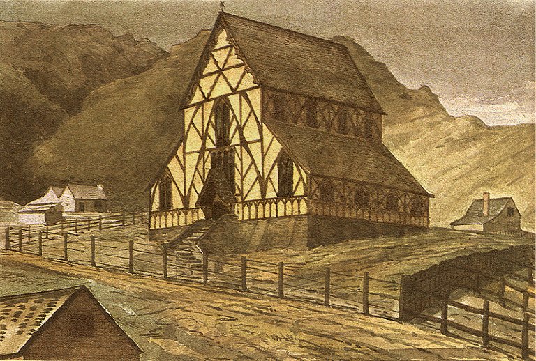
Below: to the far Right can be seen the 1860 Anglican Chapel of Ease of St Luke the Evangelist at the north-east corner of Kilmore and Manchester Streets. Another aisle was added in 1864, with a tower and spire built a decade later. Now known as St Luke's in the City, the slate roofed wooden church was rebuilt in stone in 1908.
By the time that this view was drawn the Utopian dream had succumbed to utilitarian pragmatism, the population was approaching 2,000, a telegraph line connected the city with its port, Kerosene lamps had been installed as street lighting and the old wharf was still in regular use by small steamers.

But six years later the Waimakariri River would reclaim its flood plain and the Avon rose to the limits of its upper banks as seen in the foregound of the drawing (below). Major civil engineering work ensued and in 1871 the original land contours in this vicinity disappeared beneath a gravelled Oxford Terrace.


The Alexander Turnbull Library reference:
Artist unknown :[Avon River, Provincial Court buildings and houses, Christchurch. 1870-1875?]
Reference number: C-081-006
1 drawing(s). Pencil drawing, 249 x 535 mm.. Horizontal image.
Part of Artist unknown :[Eight pencil sketches of Christchurch buildings and the Avon River. 1870-1875?] (C-081-003/009)
Drawings and Prints Collection.

Jun 6, 2009

2009 Heritage Grants Illustrated


On Friday, the 5th of June the Christchurch City Council issued a press release announcing the Heritage Grants and Covenants Committee's grants for 2009. We illustrate and quote from that media statement. Our editorial comments are in blue.


Just over $27,000 has been granted for conservation work on Acland House. The house was built around 1893 and was named after the Chairman of the school board when the hostel was established in 1921. The building is a group three listed building in the City Plan.

Situated at 85 Papanui Road, Merivale, and renamed to commemorate Sir Hugh Thomas Dyke Acland (1874-1956), the house is a residential facility for approximately 90 Christchurch Girls' High School pupils.


The committee has granted $3,500 to install protective glass in a cell at Addington Prison to cover sketches done by inmates. Addington Prison was built to relieve congestion at the Lyttelton Gaol, the City’s first and only penal institution at the time. It is a good example of a Victorian jail and was constructed in 1872. The jail is also of significance for its connection to Edward Seager, who was Canterbury’s first police sergeant, Addington Gaol’s first gaoler, and Sunnyside Hospital’s first warden. The grant follows an earlier one, made in June last year, of $50,000 for internal and external maintenance and restoration work.

Built to the neo-Gothic design of the Architect Benjamin Mountfort in 1874, the building replaced an earlier prison in Armagh Street. Closed in 1999, the original cell block has been a Backpacker's Hostel since 2006.


A grant of nearly $8,000 will be used towards repainting the exterior of the Highpara Apartment building in High Street. The three storey building is one of a number of listed premises on High Street that contribute significantly to the streetscape of this inner city precinct. In the 1980s the first and second floors of the building were converted to residential use, providing 27 warehouse-style apartments.

Built in 1884 as a block of retail premises, the current name derives from the Para Rubber Company having been a long term tenant of the corner shop.


BEFORE


AFTER

A commercial building at 68 Manchester has attracted a grant of just over $8,000. The two storey, group-three-listed building was designed by Samuel Farr in 1877 and is one of a number of listed buildings on Manchester Street that contribute to the low-rise classical streetscape of the area.


A grant of $26,000 has been allocated to work on a Cunningham Terrace, Lyttelton, house. The house is an early colonial dwelling built in 1874 for Peter Cunningham, a landowner and grain exporter who was a founder member of the Lyttelton Harbour Board and an original shareholder in the Canterbury Club. The house is an elegant two storey triple gabled timber dwelling with decorative finials and bargeboards. The grant will be used for replacing the roof, exterior painting, and replacing rotted timber.

Purchased from the Honourable John Thomas Peacock, Peter Cunningham was the owner of Peacock's Wharf, over which his house enjoyed a commanding view. Now much enlarged, and the dock for the inter-island RoRo cargo ferries, the port's second jetty is more prosaically renamed as No 7 Wharf.


The Piko Wholefoods building at 229 Kilmore Street is a two storey brick building built in 1905. A grant of $10,000 will be used for maintenance on the brick, stone and timber work.

Originally the retail premises of a Painter and Paperhanger, the upper floor was first occupied by James Wyn Irwin, promoter of the Shorthand dictation method and Australasian representative of The Gregg Correspondence School. The building has been occupied by the Piko Wholefoods Coöperative since 1981.


A grant of nearly $6,000 has been approved for work on the Cashmere Hills Presbyterian Church at 2 Macmillan Avenue. The church was designed by Cecil Wood in 1926 and built in 1929 of Port Hills basalt with a slate roof. A substantial amount of the grant will be used towards restoration of five stained glass windows and installation of protective glass shields to the north and east facing windows.

May 20, 2009

Newtown, Christchurch


A source of confusion to family historians are references to the Christchurch suburb of Newtown, often mistaken for the Wellington suburb of the same name.

Newtown was the original name for Sydenham. Although constituted as the Sydenham Borough in 1877, the original name was still in common use three years later.

A 126 acre residential subdivision dating from 1861, by 1885 the borough comprised 45 kilometres of formed streets and a population of 9,500. The later name appears to derive from the Sydenham Academy, listed in 1860 as the Tuam Street school of Charles Prince (public schools were not established in Christchurch until the 1870s - it was not deemed necessary to educate the children of the labouring classes in the first two decades of settlement).

The above photograph is a southerly view of Colombo Road, Newtown (subsequently to become an extension of Colombo Street). In the middle distance can be seen the extant 1877 Wesleyan Methodist church at the corner of Brougham Street. Below is an 1877 envelope adressed to the recipient at the Newtown Post Office, Christchurch.


Addendum


A mud brick (cob) cottage built on the northern side of Brougham Street East in the year following the original 1861 subdivision. It was demolished after 1912, when the photograph was taken.

May 11, 2009

Historic 1879 Christchurch Photograph Identified


Unidentified until now is a photograph that will be familiar to many with an interest in Christchurch history.

Taken in Cathedral Square in May 1879, it shows a large wooden building in the process of being relocated. In the background is the newly completed Government Building, subsequently the Chief Post Office and now the tourist information centre.

During that era pressure for commercial redevelopment within the inner city saw many dwellings from the earliest residential areas moved to what are now the inner suburbs, where they continue to survive into the twenty-first century.

Shown above is the 1868 Baptist church on its way from Hereford Street to Oxford Terrace. Built for £272 on the site now occupied by the central Police Station, it was relocated next to the subsequent Baptist Tabernacle (below), which continues to occupy the south-east corner of Madras Street and Oxford Terrace.


Enlarged upon its new site, the church re-opened on the 29th of June 1879, becoming the Baptist Sunday School on the completion of its neo-classic replacement in 1882. Damaged by fire in 1903, the front part of the 1868 church was replaced in brick (below). Aerial photographs indicate that the Sunday School was demolished in the early 1970s.


Photo Credits: top; Christchurch Star newspaper archives, center; Early Canterbury Photographers, Bottom; Frederick George Radcliffe (1863-1923).

Apr 14, 2009

1906 Christchurch Panorama


LARGE IMAGE OPENS IN A TAB OR NEW WINDOW

Photographed from the southern tower of the New Zealand Exhibition building is this easterly 1906 panorama of Christcurch. Restored from three photographs, across the foreground is Park Terrace.

1. The house to the extreme Left was constructed by George Braund Woodman in 1858. Originally a carpenter, Woodman (1826-1890) became a partner in the road contracting enterprise of Woodman & Wright, using much of the profit to make pastoral investments in the Ellesmere district.

Woodman was also the first Publican of the Devonshire Arms Hotel, original home of Latimer Square's Christchurch Club. Dating from 1852, the Devonshire Arms on the south-east corner of Durham and Peterborough Streets was rebuilt in 1876 as Barrett's Family Hotel to the design of the renowned William Barnett Armson. Subsequently renamed the Gladstone Hotel, it was one of the city’s oldest hostelries, being demolished in 2005 to make way for an office building. Parts of the 1876 structure have been incorporated in the new building.

2. Set in spacious grounds to its Right, at the corner of Kilmore Street, is the much enlarged Macfarlan house of 1864.

3. The dwelling on the opposite corner is yet to be identified, but above it is Cranmer Square and on the sky line can be seen the tall chimney of the Christchurch City Council's 1903 refuse destructor near to the corner of Manchester and Armagh Streets. The incinerator not only generated the city's first electricty supply (with a pair of 100 Kilowatt generators driven by two steam engines), but also heated the adjacent 1908-1947 swimming baths in Manchester Street.

4. To the centre foregound, at the northern corner of Park Terrace and Chester Street, is the Reginald Cobb house of 1871. Cobb was a partner with Henry Sawtell in Cobb, Sawtell and Company, general, wine and spirit merchants and agents for the New Zealand Loan and Mercantile Agency. In 1916 it would become Helen Connon Hall, a hostel for 70 university students until 1974. Sold by the University of Canterbury to the 1881 Cathedral Grammar School and renamed Chester Hall, it was demolished in 2001. The site is now occupied by the relocated 1886 St Saviour’s church from Lyttleton.

5. On the other corner of Chester Street is the 1880 home of the Reverend William Henry Elton (1845-1914), Cathedral Precentor. Elton's house was later purchased by the Church Property Trustees to become the Cathedral Grammar School. It was demolished in September 1985.

6. Next to it is the much smaller Sanders house, built in 1880 and demolished 1977.

7. To the far Right, at the corner of Rolleston Avenue and Armagh Street is the extant 1867 house built for the lawyer George Harper, fourth son of the city's first Bishop. It has been owned by the nearby Christ's College since 1918.

Apr 4, 2009

Christchurch's First Palace


Situated on the quarter acre Town Section 404, the first house on the western side of the Avon River was built in 1851 by Henry John Cridland (1821-1867), Superintendent of Public Works for the Canterbury Association from 1849. A New Zealand Company surveyor from 1843, Cridland was also an artist, architect, and like many of his lower middle class contemporaries, a political schemer and property speculator.


By 1856 a large extension had been added to the rear of the house. In December of that year the Cridland family moved to their farm at Hoon Hay and the house became the episcopal palace of Henry John Chitty Harper (1804-1893), first Bishop of Christchurch. Harper and his large family, who fetched water from the river, occupied the house until the completion in late 1858 of the much grander Bishopscourt on nearby Park Terrace.


Situated on Cambridge Terrace, equidistant between Worcester and Hereford Streets, the house was the only occupant of the block's river frontage until 1863 when the first Public Library building was completed at the Hereford Street corner and then the Canterbury Club to the Worcester Street corner 1874.


In later years the old house appears to have been occupied by staff of the Canterbury Club. Demolished between 1918 and 1920, the site became part of the Club's garden, which was replaced with a sealed car park by 1965. As such it remains.


Harper's residential predilection for the western side of the Avon River, rather than the extensive Anglican church lands in the vicinity of Cranmer Square, was probably instrumental in the development of the area as the salubrious suburb of West End, much favoured by the professional classes.

The subsequent development of the Canterbury University College on what had previously been a residential block attracted academics to the suburb from the mid 1870s. By the 1930s many of the grand homes had become private hotels and rooming houses for the College's students.

A thriving bohemian culture developed among the artists, writers, poets and musicians who occupied the quarter through the following decades. Toward the latter part of the twentieth century the bishops, accountants and lawyers moved on to suburban Cashmere, the University left the area and much of the built heritage was replaced high rise concrete.

The city's first suburb, which was subsequently associated with many of the most illustrious names in the New Zealand arts community of the twentieth century, lost its name, social cohesion and much of the former aesthetic.

Photo Credits: the Canterbury Museum, the Christchurch Public Library, the Christchurch Art Gallery and the Alexander Turnbull Library.

Mar 8, 2009

Old Lyttelton (for Richard)

These are old survey maps and photographs of the intersection of Lyttelton's Winchester and Canterbury Streets.

A north-easterly view across the intersection in 1858.


An 1860 survey map.


The north-west corner about 1865.


A survey map showing the extant buildings in 1867.


A circa 1890 elevated north-easterly view (above). At the north-eastern corner, the home of the Tobacconist William Wales Junior was completed with the addition of a western wing by 1901. The same house photographed in 2007 (below).


Hatherly's grocery shop on the southwest corner in 1901.


The 1860 Anglican church of the Holy Trinity and the 1880 vicarage at the southeast corner, photographed prior to 1906.

Jan 1, 2009

Now and Then: Christ's College


More than a century apart, these photographs are views of the south-eastern side of the quadrangle of Christ's College on Rolleston Avenue.

To the Left in the earlier image is the Architect Benjamin Mountfort's 1859 Synod Hall and Library for the Anglican Diocese of Christchurch. Built in the medieval Gothic revival style, it was demolished in 1919. The building's original doorway and portico survive as a gate between the College grounds and the Botanical Gardens.

Dec 11, 2008

Recent Photographic Acquisitions

Some previosly unpublished, restored and geo-tagged images of old Christchurch that have recently been added to the archive.


An 1883 northery aspect of Colombo Street from near the northwest corner of Cashel Street. The view is across The Bottleneck at the junction with Hereford and High Streets. To the far Left are the premises of the Confectioner Thomas Gee, who would later occupy the northeast corner of Colombo Street at Cathedral Square as the Broadway Tea Rooms.


This is a circa 1877 photograph of the Botanic Gardens on Rolleston Avenue. Taken from near the main gates of the gardens, it is a southerly view towards the 1866 South Lodge, home of the Botanic Garden's first Curator John Francis Armstrong (1840-1902). The lodge was replaced by the extant Curator's House in 1919. Beyond it can be seen the early buildings of the Christchurch Hospital.


A circa 1875 view of the 1858 Ohinetahi homestead at Allandale, Governors Bay on Lyttelton Harbour. Built by Thomas Henry Potts (1824-1888), it is the home of the Architect Sir Miles Warren in 2008.


A circa 1875 southeasterly view of the 1859 water mill, situated where the Hereford Street bridge on the Avon River now stands. The Mill was demolished in 1897.


A pair of photographs depicting St Michael's Church and Vicarage on Oxford Terrace at the junction of Lichfield and Durham Streets. The circa 1885 photographs are attributed to Alfred V. Gadd (1833-1910), whose London Portrait Gallery was active from 1876 to 1893.

A part of the photograph showing the winter scene was published in Gwenda Turner's 1999 book Christchurch - An Enchanted Journey Through the Garden City.


An elevated northeasterly view from the tower of Ward's Brewery on Fitzgerald Avenue. Taken about 1885, it includes Avonside Drive and River Road. To the lower Right foreground is the extant 1852 Englefield Lodge (the city's oldest house). This photograph currently forms the Right hand end of an eight photograph panorama from the brewery tower, which will be published when the missing two photographs have been located.


Known as the Ilam homestead, this huge house began life as a pair of joined kit set houses bought from England in 1858 by John Charles Watts Russell, J. P. (1826-75). Originally situated on a fifty acre rural block between Fendalton Road and the Deans farm, two branches of the Waimairi stream passed through the ten acres of gardens (below).


In 1866 John Russell sold most of his property and returned to England, He came back to Christchurch in 1871, where he died four years later aged 49 years and is buried in St Peter's Churchyard at Upper Riccarton.

Mrs Russell subsequently married A. R. Creyke and the Ilam land was subdivided in 1880. Later owners of the property included Leonard Harper, "Ready Money" Robinson, Patrick Campbell and G. D. Greenwood, but what had been the largest private residence in Canterbury was destroyed by fire in August, 1910. 

Edgar Stead rebuilt the house in 1914 and also developed a renowned Azalea and Rhododendron garden. Stead sold the property to the University of Canterbury and his home is now the University's Staff Club.

Nov 19, 2008

Halswell: Mount Magdala


An interesting Photographic Essay from the Slack Ninja web site.

An excerpt from the text:

"Mount Magdala was a Catholic institution run by the Good Shepherd Sister’s on the outskirts of Christchurch, near Halswell. It operated from 1888 to 1968, at which time it was taken over by the St John of God Brothers, who ran a boys home. It is interesting to note that both of these groups have paid out compensation to people who claim they were abused while in their care. There is an interesting article about abuse in Magdala institutions www.peterellis.org.nz/church/2003/2003-0503_Press_DirtyLaundry.htm


My dad ran a nearby bakery and would donate each days leftovers to the St John of God boys. Lord knows if the boys ever got the leftovers but at least the dirty old priests didn’t get their hands (or any other parts of their body!) on me! Like many large institutions of the time, Mt Magdala was largely self sufficient, which included running their own farm. There are 5 buildings left, but 4 of them have been given demolition consent. The remaining one, called the granary (a building where grain is stored) is safe for now. It is a long thin building – maybe 6m x 30m..."

Nov 8, 2008

Podcast: The Parish: administration and records

Of particular interest to family geneaologists comes a 48 minute podcast from Britain's National Archives, which gives a comprehensive explanation of the Parish system.

For hundreds of years the parish was the most important unit of local government. This talk covers the historical administration of the parish, its officials and their records, as well as showing you how you can use these records to trace your ancestors and find out more about their local community.

Sep 10, 2008

1852 Lyttelton Revisited


A digital restoration of Sir Frederick Weld's 1852 watercolour of the Holy Trinity Anglican church at the south-east corner of Canterbury and Winchester Streets.

Begun in April, 1852 and completed that year, the view is of the West front of what was technically the pro-Cathedral of the province of Canterbury (the truncated design would appear to suggest ambitious intention for its later development). Built of brick and unseasoned timber to the design of the Christchurch Architect Benjamin Mountfort, the structurally unsound church was demolished in 1857 and the extant church was erected to the East of this building and a Vicarage was built on the site in 1879.

The North-easterly foreshortened view is up Canterbury Street from the vicinity of London Street. Interestingly the house in the lower Left corner may be the 1849 home of Captain Joseph Thomas, Chief Surveyor and Acting Agent of the Canterbury Association. This dwelling is possibly now the rear wing of the extant Grubb cottage

Weld's painting is now in the collection of the Canterbury Museum.

Jul 21, 2008

Historic Church For Sale


Faced with a declining congregation and situated on what is now a valuable commercial site opposite The Palms shopping mall, the church which gave its name to the suburb of Shirley, is for sale.

Built on Craddock's Corner in 1919, the Normanesque tower was added nine years later. Both were designed by Joseph Salkeld (1866-1935), the son of an early Lyttelton Builder & Contractor. The architect was also the Choir Master of the Wesleyan chapel.

In the 1980s extensive alterations were made to the church and a new entrance was established. The exterior Sandstone facings were painted Pink, to be replaced by an equally unfortunate shade of Blue more recently.

Except for the 1938 pipe organ, the extensively modified chapel is of no particular architectural distinction and probably not worth saving. However, the 1928 tower, if restored, could prove a significant landmark as part of a commercial development of the extensive site. We trust that it will not be declared yet another "earthquake risk."

Conventional aesthetic considerations do not appear to be part of the restrictions upon exterior colour schemes within the realm of the local Council. Accordingly, something along these lines could be considered.

Further reading
Shirley Methodist Church One Hundred Years of Witness, 1966 Centennial History of the Parish (full text).

More Shirley Stories - The Press, 26 December, 1981.

Christchurch Library - Heritage: Shirley Methodist Church

Canterbury Heritage gratefully acknowledges the copyright of Jessica Park, the Methodist Church of New Zealand and New Zealand Newspapers Ltd with respect to the above images.